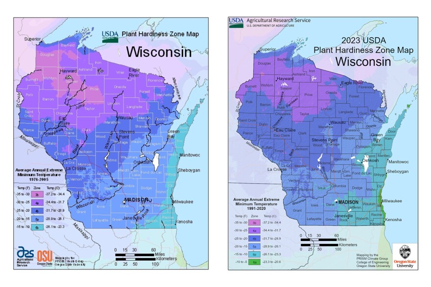
New USDA plant hardiness zone maps are now available.
The maps are used to help gardeners find plants most likely to thrive where they live.
It’s the first time in more than a decade the maps have been updated.
The new maps have shifted zones across the state as temperatures have risen over the last 30 years.
Wisconsin is now home to six zones, instead of five. The coldest zone has shrunk significantly.

Robin Indermuehle and her husband Pat own Conover Gardens Fresh from the Vine.
She says the maps are helpful but at the end of the day nothing beats experience.
“Your experience is really the best indicator of what is going to grow. If you're a new gardener, then absolutely use those maps,” said Robin. “But if you've been gardening for a long time, you have a really good feel for what grows and what doesn't grow. To try some of those newer, maybe higher zoned plants is good, but you're going to be able to tell immediately if they're going to grow or not, you'll know.”
The Indermuehle’s also say microclimates can change which plants will thrive.
In this region, that’s usually the difference between wetlands and higher elevation woodlands.
"I think back when we started, we were zone three. Sometimes we could grow zone four plants and that was really exciting. But at the same point, his parents, who live not too far from us, live in a low area. They were a solid zone three, and there was no hope of growing zone four plants there," said Robin. "It still exists today. There's little microclimates all over that it could be a warmer place, if it's near concrete, or pavement, or near a building, or it could be a lower zone, if you're near a bog or a swamp or a valley of some sort."
They do think the maps are accurate. Robin and Pat have been able to plant varieties in recent years that they never could have 30 years ago.
“Back when we started, I wouldn't have even thought of planting a pear or a peach tree,” said Robin. “And lavender,” added Pat. “They didn't hold over. They would die, you had a very high rate of death. Now it doesn't seem to be that way. You know, like lavender and that kind of whatnot, some of the woody herbs are definitely, without a doubt, surviving overwinter and that's unheard of.”


